Walks: The Great Flat Lode Trail, Cornwall

The Great Flat Lode Trail is a 7.5 mile (12km) multi-use route that encircles Carn Brea, the hill that overlooks the former industrial towns of Redruth and Camborne, in central Cornwall. The route leads you through a mixture of farmland and moorland on both unsurfaced paths and some minor roads.
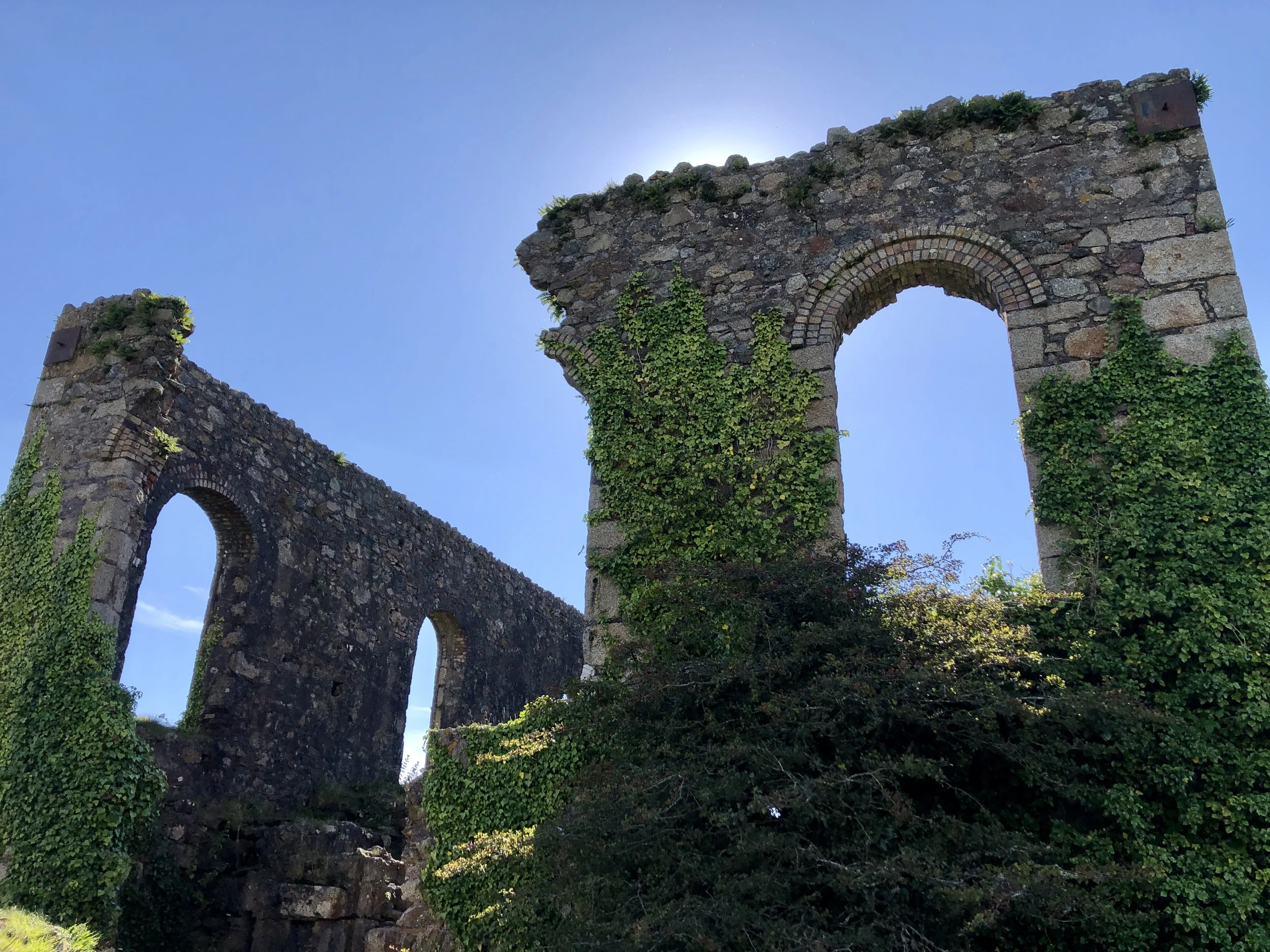
The name comes from the fact that in the 1860s, when many of Cornwall mines that had been mining copper, were closing, tin was discovered to the south of Carn Brea. In Cornwall, minerals are found underground in ‘lodes’ just as coal is found in a seam. This lode of tin was eventually found to be two miles long, and was flatter than most, lying at an angle of about 30 degrees instead of the usual 70 degrees from the horizontal, hence its name, the “Great Flat Lode”.
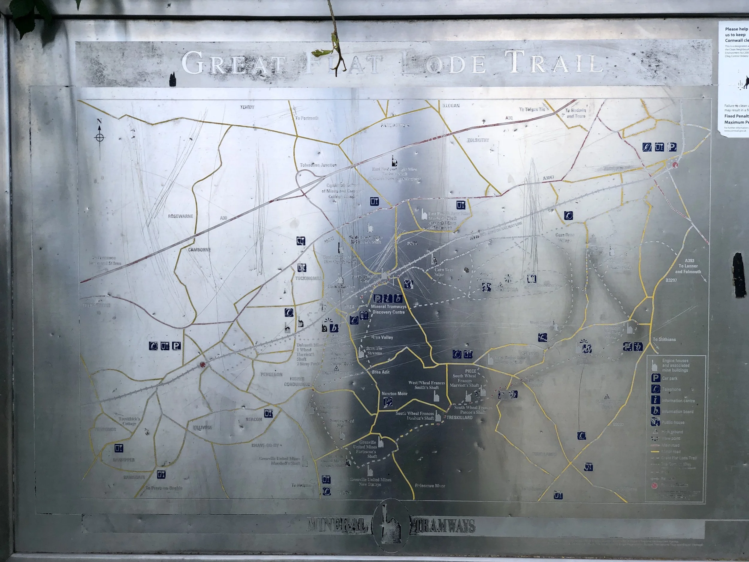
The Great Flat Lode Trail is shown on the map with burgundy coloured line. Unfortunately Outdoor Active doesn’t allow changing the colour or the thickness of the line at the moment. In the circle is the South Wheal Frances car park which is a great place to leave the car as it’s free and a decent size. It’s still worth getting in there earlier rather than later on the day, as the trail is popular with mountain bikers who also park their cars there as well as people visiting the ruins close by.
The area has plenty of trails going back and forth. The Great Flat Load trail is the dotted line in the metal plaque in the photo.
The trail itself is fairly easy going, wide and flat. Hills aren’t very steep and the trail follows some dirt roads as well.
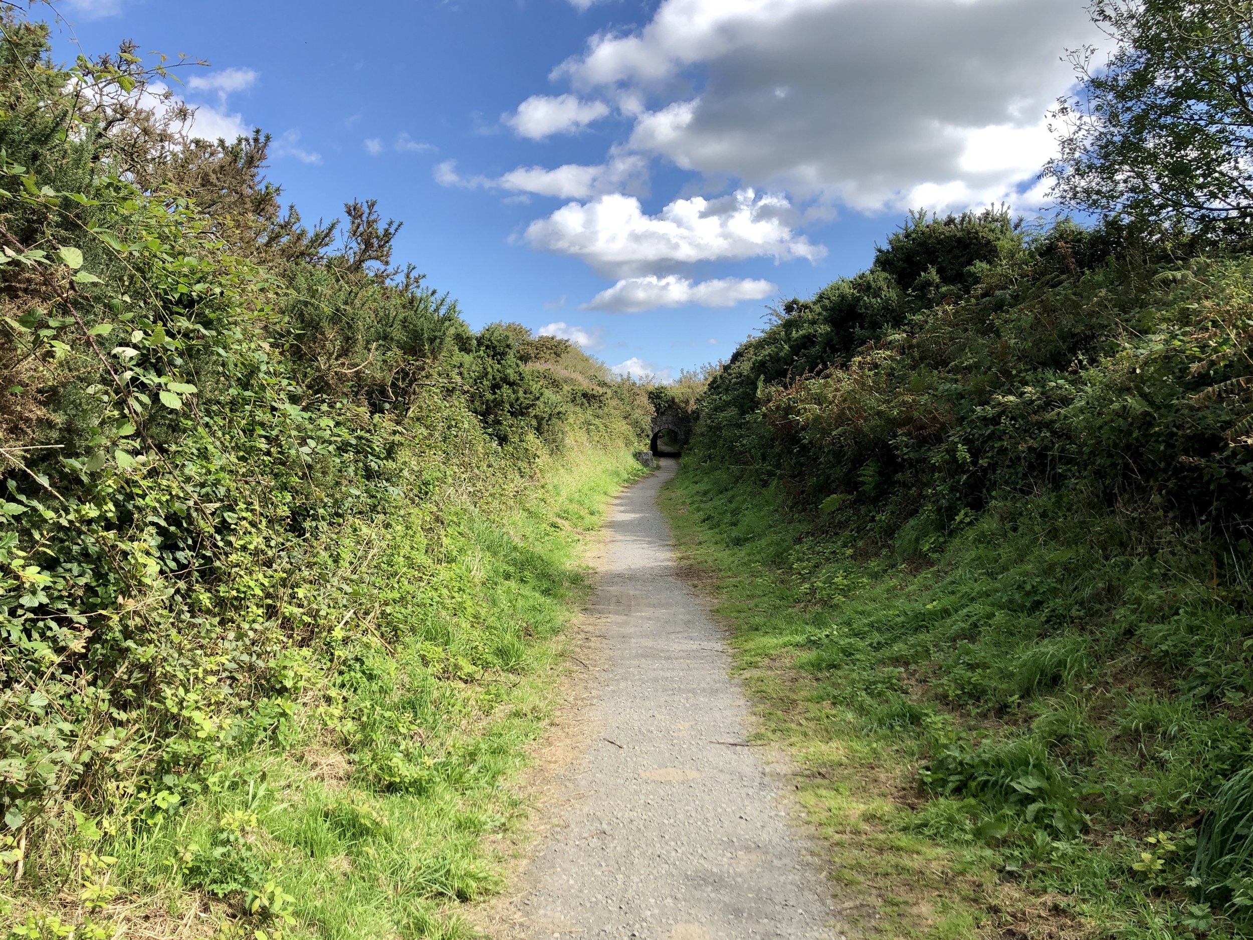
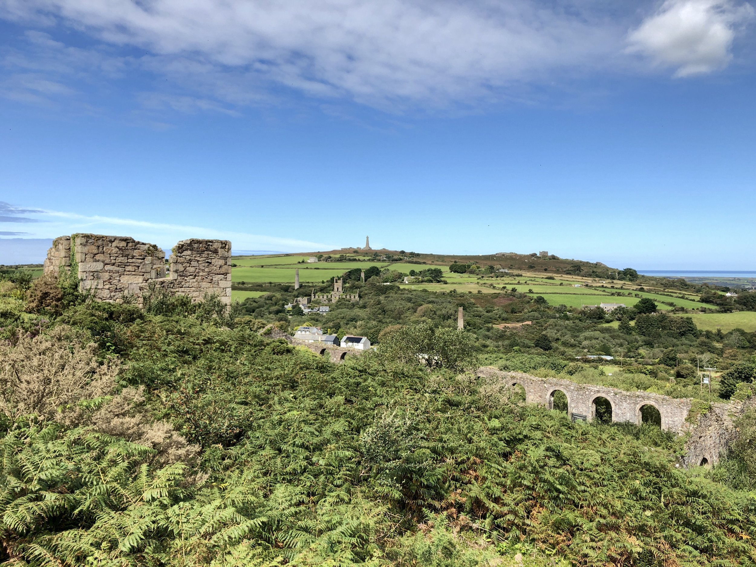
We walked the trail counter-clockwise. Soon after emerging from the sheltered trail and going under a bridge, the trail opens up on a slight hill and the views to the valley of Carnkie & Carnice open up.
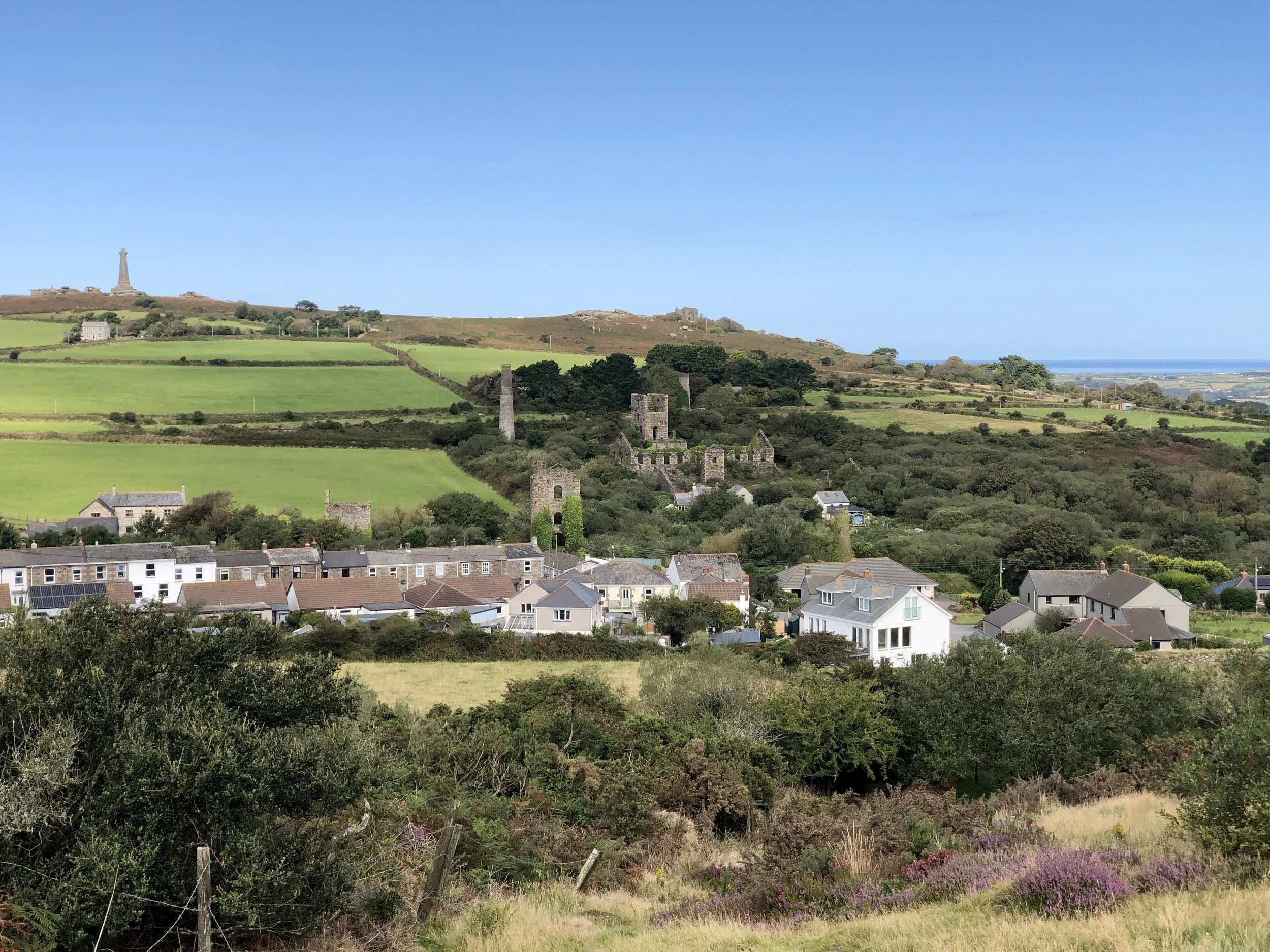
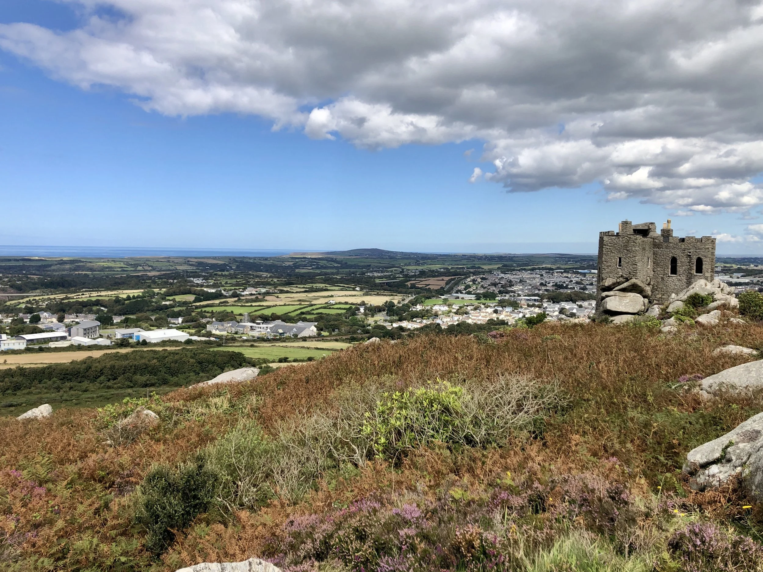
The tower on the background on both of the photos is top of Carn Brea with Basset Monument and the Carn Brea castle on its right is a restaurant.
The trail then starts to turn north towards Carn Brea and goes past large paddocks with plenty of horses (at the time of our walk).

Approaching Carn Brea the trail goes into the woods and the official trail will circle around Carn Brea, but since we’ve never been to Carn Brea, we decided to summit it from the trail.

If you’d rather just check out the views without a walk, there’s car access and a car park next to the restaurant. From the top, there are great views of Redruth.
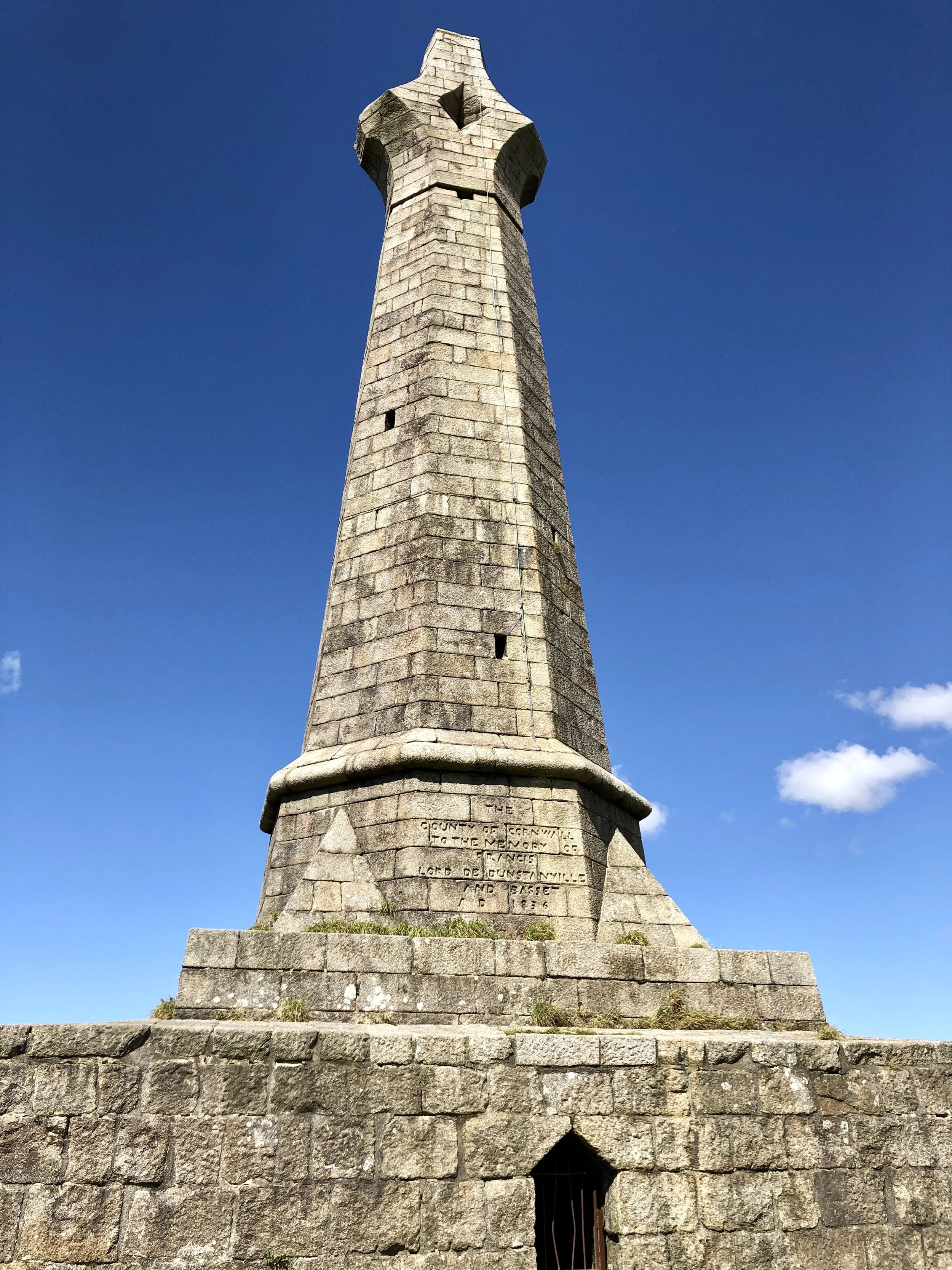
Close to the castle, there’s the Basset Monument.
Francis Bassett did a lot to improve the welfare of the miners who worked for him. He was also a patron of various other worthy causes. When he died in 1865, 20,000 people formed a procession at his funeral and all the mines were shut. The memorial monument was built with money donated by the public (whether it was advisable not to donate is questionable!). Another legacy of the Bassett family is Carn Brea Castle. It is suggested that it started out as an Elizabethan hunting lodge - the current form is a Victorian folly and is now a resteraunt. Carn Brea also has associations with the legendary giants of Cornwall. It is said to be the home of the giant Bolster who when standing could put his other foot on top of St Agnes Beacon over 10 miles away!
From the top, there’s a very easy decent towards southwest. Since we summited Carn Brea, we missed the part of the trail which goes around the Carn Brea following the rail line. We joined the official trail by Tesco Extra, but on this side of the tracks. Here we kind of lost the trail, as there was only a busy road with blind corners to walk, so I thought that the GPX-file I had wasn’t entirely correct. We ended up going over the rail line and walk on the high street a bit before walking over a disused bridge to join the trail. This would take us to the South Wheal Frances Counthouse, which is an old copper and tin mine ruin close to the car park where we set off.